|
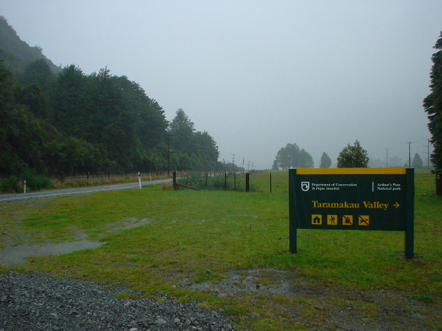
| Section K starts at the Taramakau River access track on Highway 73 near Arthur's Pass |
|
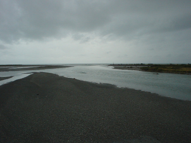
| Hokitika River flowing into the Tasman Sea. From Hokitika southward, Highway 6 goes almost 400 km along the narrow coastal strip on the western side of New Zealand's famed Southern Alps and over Haast Pass to the interior before reaching the first highway junction near Wanaka (there are no other roads over the Alps between Arthur's Pass and Haast Pass). |
|
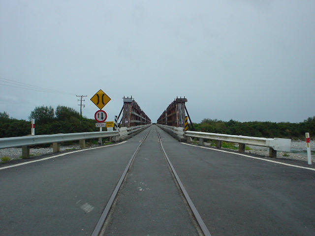
| One-lane bridges are common in New Zealand, even on major highways. One side of each bridge is always signed to yield (give way) to traffic on the other side. More unusual, on Highway 6 there are two one-lane road/rail bridges both cars and occassional freight trains to Hokitika |
|
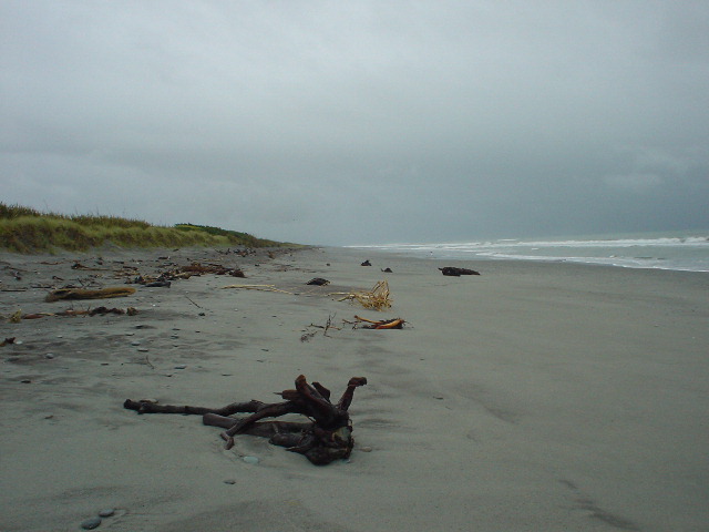
| The first half-day south of Hokitika proceeds along a Tasman Sea beach. After that, it's Highway 6 for 170 km to the Copeland Track. The beach could be followed down much of the west coast were it not for the many mighty rivers draining the Southern Alps, with only one bridge across each river--on Highway 6. |
|
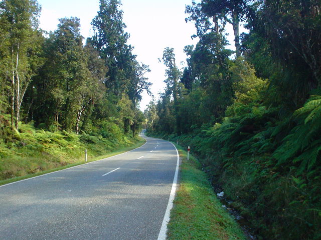
| Highway 6 is quite pretty, alternating between forest and farmland. The majority of traffic seems to head south, making my northbound lane uncrowded, and with a grassy/fine-gravel shoulder to walk on most of the way, easy on the feet. |
|
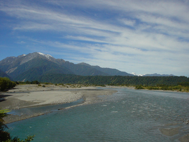
| First glimpse of the snow-covered parts of the Southern Alps, seen up the Waitaha River valley |
|
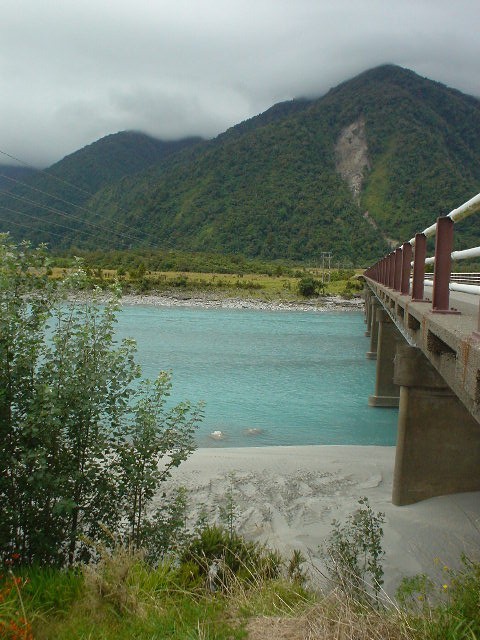
| Road bridge across the Whataroa River. This one and the Wanganui River farther north were a beautiful bright tourquoise blue. |
|
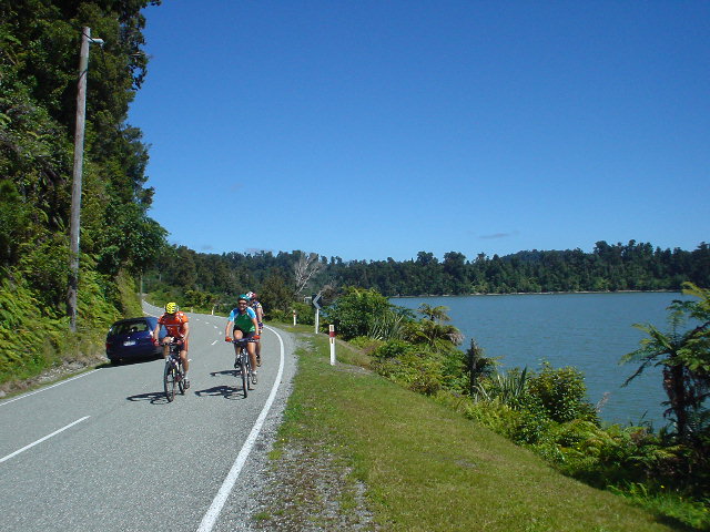
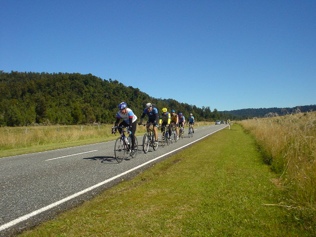
| Cyclists passing Lake Wahapo on the 2004 Great New Zealand Bike Ride, just north of Franz Josef Glacier. 1100 cyclists passed me on the road in the space of 4 hours, making for pleasant comraderie and a chance to exchange road-side enthusiasm with more Australians (90% of the riders) than I had ever met before. |
|
| The road was full of passing cyclists all morning |
|
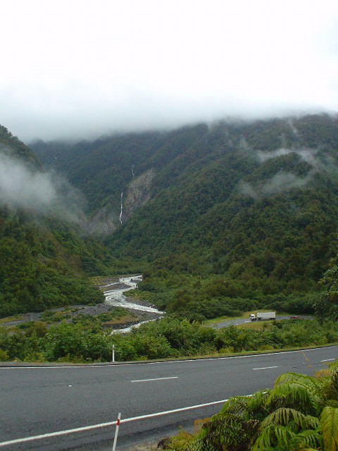
| Between the towns of Franz Josef Glacier and Fox Glacier, the road climbs into and out of several deep river valleys. The cars seemed to have more trouble with the winding steep sections in the rain than I did! I felt at home here, like on a tramping track. The cars, perhaps one every 3-5 minutes going slowly, were simply making their way through, the same as me. |
|
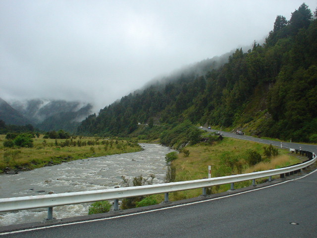
| The land is quite rugged, and walking through the vastness and wildness of it, even while sharing the road with camper-vans, motorcyclists, and tour buses, made the West Coast seem quite empty. Only in the cafes and tour desks of the one-block-long towns of Franz Josef Glacier and Fox Glacier, and on the buses themselves, does one feel crowded. |
|
| View up the Cook River, from highway bridge, towards La Perouse Peak (3079 meters) |
|
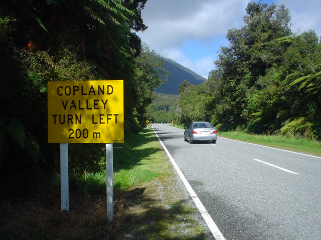
| Hooray! The end of 250 km of road walking to the Copeland Track |
|
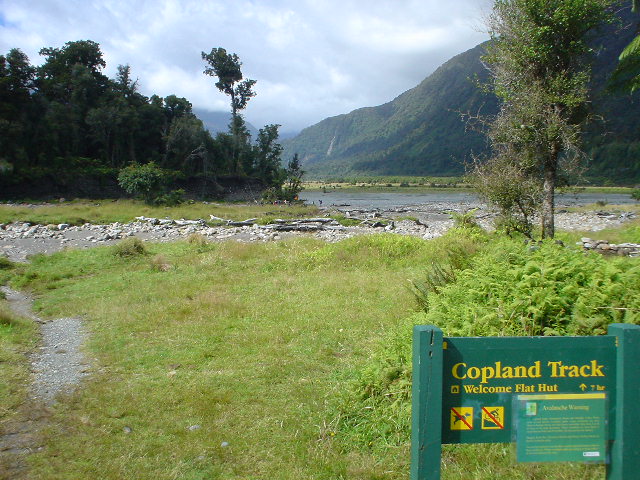
| Start of the Copeland Track, looking up the Copeland River Valley |
|
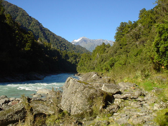
| Heading up the Copeland River to Welcome Flat Hut the first day, over frequently rocky terrain |
|
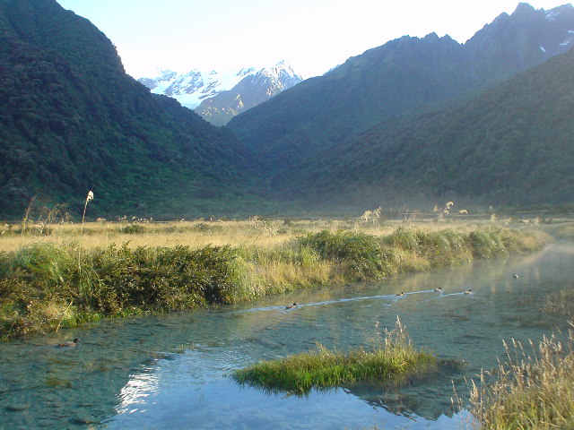
| Welcome Flat, with snow-clad peaks in background |
|
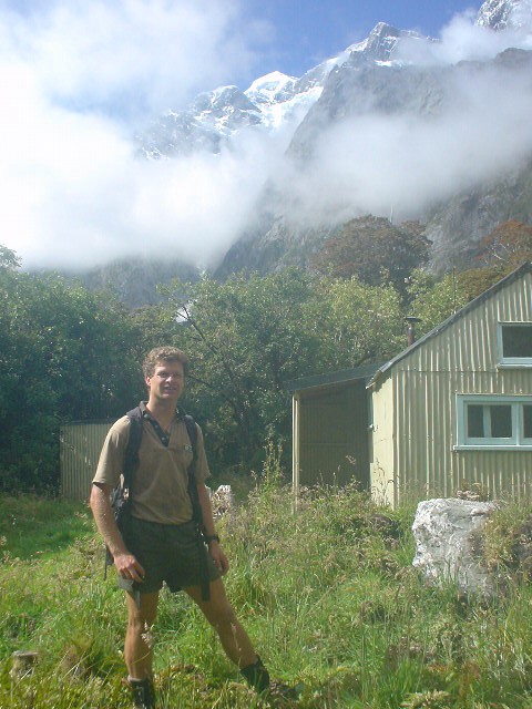
| Hut warden Tim Mulliner at Douglas Rock Hut (another 3 hours up the Copeland River from Welcome Flat, where he is based), with Mt. Sefton in the background. Tim was doing a great job of maintaining the Copeland Track itself, as well as watching over and advising the multitude of trampers who come up to Welcome Flat Hut for the hot springs (over 25 people each night I was there). Tim had a two-way radio and posted daily weather reports. |
|
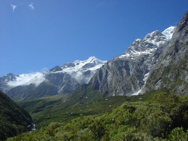
| The Southern Alps, from the Copeland Track above Douglas Rock Hut |
|
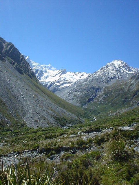
| View of Mt. Cook (sharp point just to left of center) and Lean Peak (larger rocky top to the right) from the Copeland Track just below Copeland Pass. Mt. Cook is about 10 km distant, to the Northeast, at 3754 meters elevation the tallest peak in New Zealand. Copeland Pass is to the right of Lean Peak. |
|
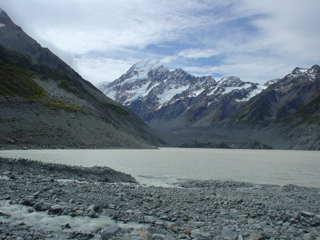
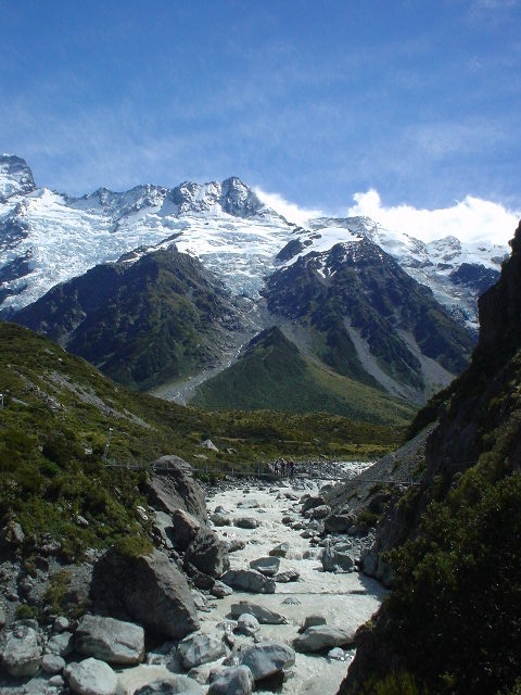
| View of Mt. Cook from Hooker Lake on the east side of the Southern Alps, just 5 kilometers in straight-line distance from the point I reached in the Copeland Valley on the west side of the Alps |
|
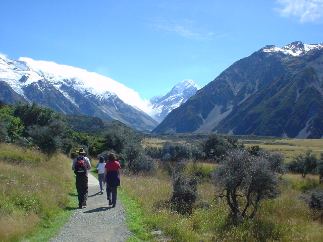
| View of the Southern Alps descending from Hooker Lake. Copeland Valley is just on the other side of the range seen here, which includes "The Footstool" peak. |
|
| view of Mt. Cook from Mt. Cook Village. |
Page updated March 9, 2004