|
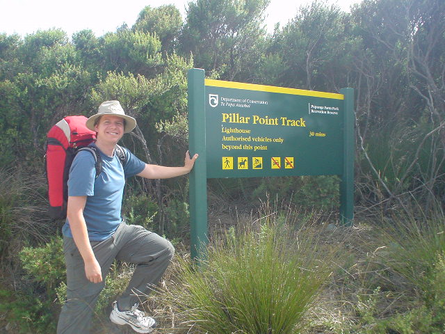
| Section I starts at the Pillar Point lighthouse at Cape Farewell, at the very top of the South Island. Section I was hiked with running shoes and a very light pack, as accomodation and food were plentiful along the route (sleeping bag and cover fit in the small 45-liter pack so I did camp as well). |
|
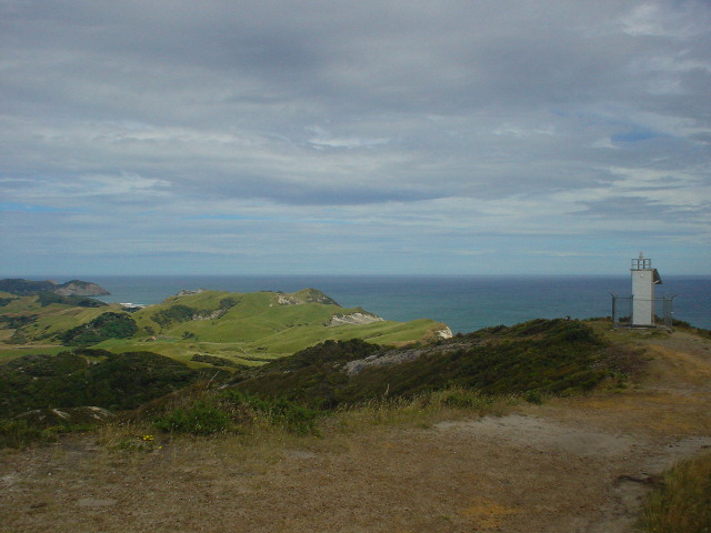
| Pillar Point lighthouse. I liked the symmetry of starting here, similar to the lighthouse at Cape Reinga at the top of North Island. But this means Section I does not follow the Te Araroa route, which starts instead at Ship Cove in the Queen Charlotte Sound (I join Te Araroa again in St. Arnaud at the start of Section J). |
|
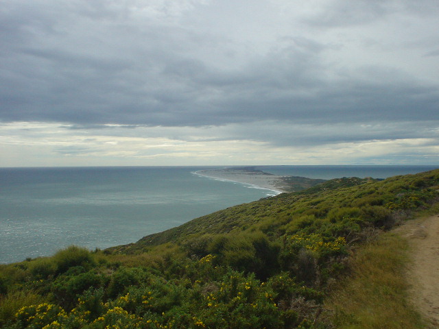
| Farewell Spit, on the east side of Cape Farewell, is a nature reserve with restricted access and "an internationally important wildlife habitat for large numbers of wading birds which migrate from the Northern Hemisphere" (Kahurangi Parkmap). |
|
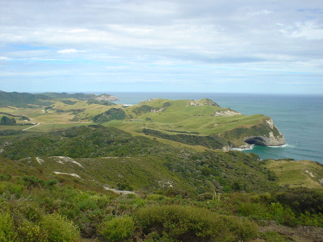
| Cape Farewell is not as isolated as Cape Reinga, and sees much more tourist traffic, but is equally beautiful. |
|
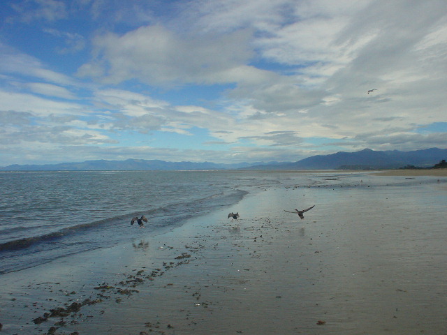
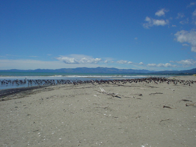
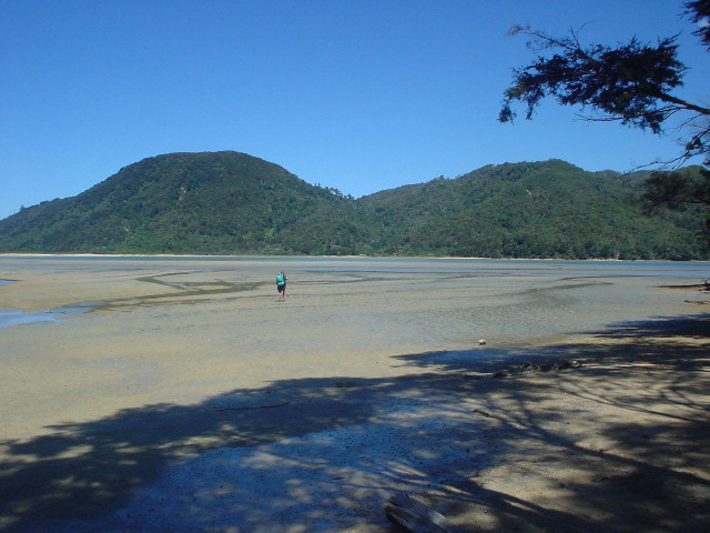
| The coast south from Cape Farewell, almost all the way to Abel Tasman National Park, can be walked along the beach and across several sandy inlets during low tide. Birds are plentiful along the tidal coastline. |
|
| These Oystercatchers were congregating en-masse and paid me little attention. However, lone birds were very territorial and repeatedly tried to dive-bomb me as I walked by, presumably through their nesting territory. |
|
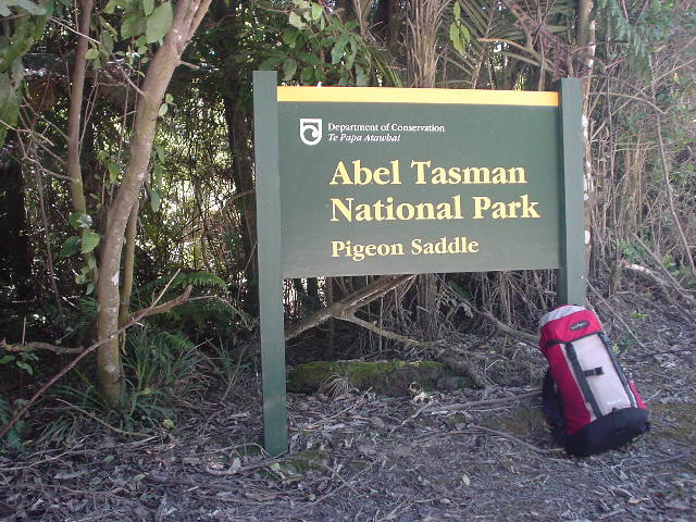
| Abel Tasman National Park is entered via Pigeon Saddle on the road from Takaka and Pohara. This was my first National Park in New Zealand, as all the other tramping routes have been in "forest parks" which are not as well developed. Abel Tasman sees 30,000 visitors per year, the most of any in New Zealand, and I passed people probably every ten minutes all day long on the Coastal Track--but still it did not seem crowded. |
|
| Awaroa Inlet 4 hours before low tide. The Coastal Track goes right across to the opposite side, and must be hiked within 2 hours of low tide to get across. I got here early and took a nap! |
|
| Same scene, 2 hours later. Two hours before low tide, it became possible to cross the Awaroa Inlet with water only thigh-high. I ate at the nearby Awaroa Lodge cafe, making it possible to tramp the Coastal Track right through the park without carrying hardly any food. |
|
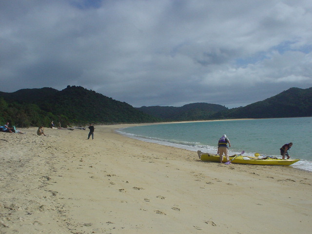
| Abel Tasman "has some of the best sea kayaking in the world," according to NZ tourist literature. Many kayakers, such as these just leaving a campground on Onetahuti Beach, were seen plying the coastal waters. |
|
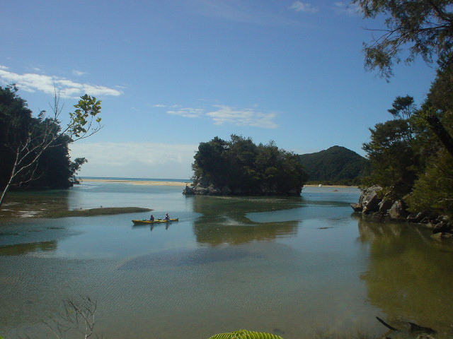
| Kayakers in a scenic tidal inlet along the Coastal Track |
|
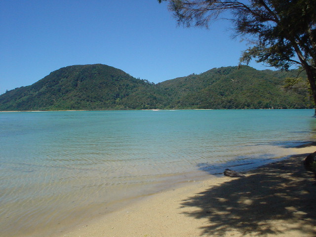
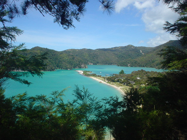
| The torquoise-blue waters of Torrent Bay. One can see why Abel Tasman is so popular and is known around the world. Many visitors were day-trippers catching water taxis to and from popular spots in the park, such as Torrent Bay, while others carried fully-loaded packs along the Coastal Track to the park's shoreline huts and campsites. |
|
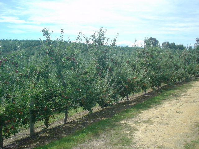
| Apple orchards! Near Motueka, a nice change of rural scenery from the livestock pastureland which dominated rural landscapes on the North Island. |
|
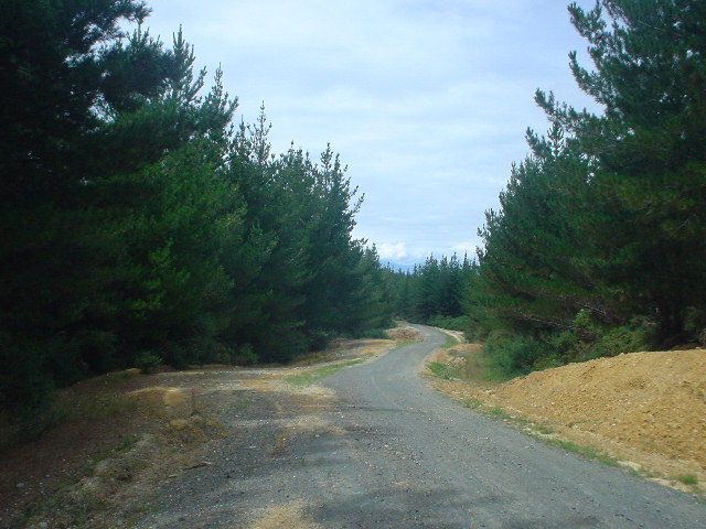
| The Old Coach Road from Motueka was a flat ridgetop route for 20km, on mostly empty gravel road, with open views of Tasman Bay to the east and the Moutere river valley to the west, often through thick pine forest |
|
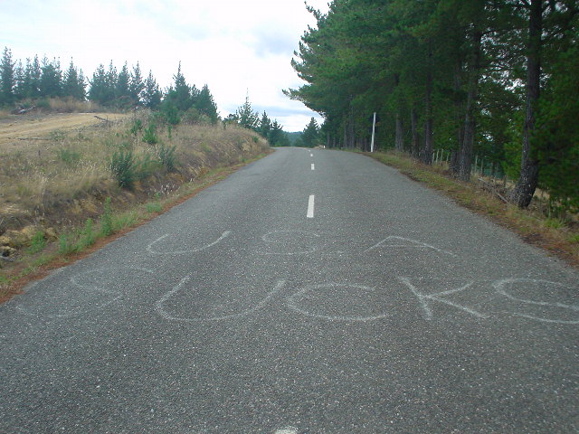
| The first explict anti-U.S. indication I've seen, on the Old Coach Road just south of Mahana. But it's not a political message; a U.S. property developer has been building houses in the area, inflating local prices, and bragging in a U.S. newspaper article how easily he can take advantage of kiwis. So locals are being rubbed the wrong way by this guy, apparently. |
|
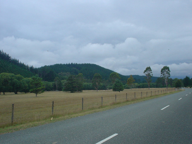
| Beautiful Pigeon Valley late in the day--with grazing sheep and goats--just before arrival in Wakefield. |
|
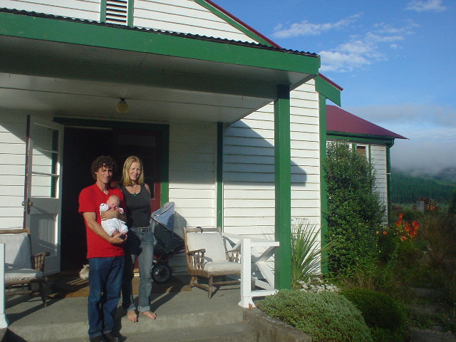
| Willy and Rewa and Golden Downs Lodge--wonderful people who run a comfortable and peaceful lodge with delicious meals in the small settlement of Golden Downs (population now about 3 persons). www.goldendowns.co.nz |
|
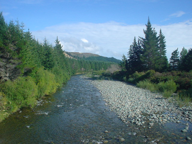
| View of the Motueka River from the Kerr Hill Road bridge in the Golden Downs Forest on the way to St. Arnaud |
|
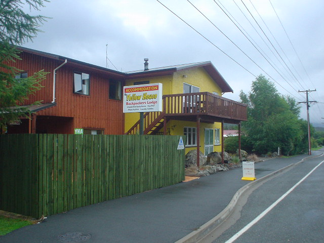
| The famous Yellow House backpackers hostel in St. Arnaud was the terminus of my Section I route |
Page updated February 1, 2004